Singapore
Sentosa Island: Singapore's Pleasure Island
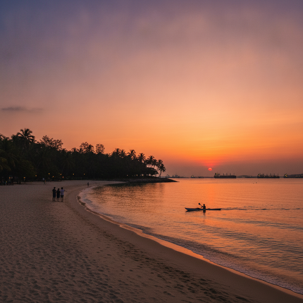
Sentosa Island, connected to the southern tip of Singapore's main island by the Sentosa Gateway road causeway (opened 1992), a pedestrian boardwalk, and the Sentosa Express monorail from VivoCity, was until 1972 a British military base known as Pulau Blakang Mati ('island of death from behind' in Malay, referring to pirate raids) and before that a kampong of Malay fishing communities. Renamed 'Sentosa' (meaning 'peace and tranquility' in Malay) and developed as a resort from the 1970s, the island now hosts Resorts World Sentosa (the integrated resort containing Universal Studios Singapore, S.E.A. Aquarium, and the Casino), three beach areas (Siloso Beach, Palawan Beach, and Tanjong Beach), Heritage Station, and the cable car terminal connecting to Mount Faber on the mainland — the first cable car system built in Southeast Asia (1974).
East Coast and Katong: Peranakan Heritage and Seaside Singapore
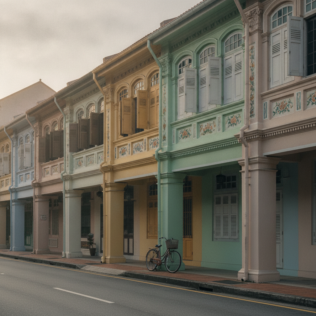
Katong and Joo Chiat, adjacent neighborhoods in Singapore's East Coast district, constitute Singapore's most important Peranakan (Straits Chinese) heritage quarter: a residential area that developed from the 1900s to the 1940s as a prosperous suburb of wealthy Baba-Nyonya Chinese families (the Peranakan community — Chinese men who intermarried with Malay women in the 15th–19th centuries, creating a distinct hybrid culture of Chinese-Malay cuisine, fashion, language, and architecture). The neighborhood's physical legacy is the finest intact collection of Peranakan shophouse architecture in the world: Koon Seng Road, East Coast Road, and Joo Chiat Road all contain long terraces of pre-war shophouses decorated with the characteristic Peranakan combination of Chinese motifs (phoenix, crane, bamboo), European architectural elements (Corinthian pilasters, arched windows), and Malay decorative tiles (encaustic tiles in floral patterns set into facades). East Coast Park, immediately south of the neighborhood running along 15 kilometers of reclaimed coastline, is Singapore's most-used outdoor recreation space.
Marina Bay: Singapore's Futurist Waterfront
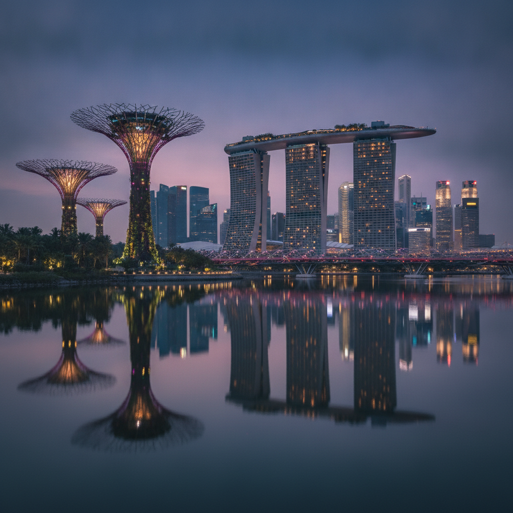
Marina Bay is Singapore's defining modern set piece — a 360-hectare reservoir and surrounding waterfront district completed in stages from 2006 to 2012, centered on the bay formed when the Singapore River was dammed at its mouth to create Marina Reservoir (Singapore's 15th and largest reservoir, supplying roughly 10% of national water demand). The district was built almost entirely on reclaimed land — the area was open sea until the 1970s and 1980s — and now contains Marina Bay Sands (the integrated resort and hotel that defines the global image of modern Singapore), Gardens by the Bay (a 101-hectare horticultural park containing two cooled conservatories and 18 Supertrees), the Esplanade (Singapore's performing arts center), the Helix Bridge, the ArtScience Museum, and the Merlion Park, all linked by a 3.5-kilometer waterfront promenade that can be walked in under an hour.
Little India and Kampong Glam: Singapore's Indian and Malay Quarters
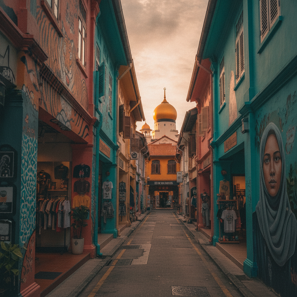
Little India and Kampong Glam are two of Singapore's four historic ethnic quarters (the others being Chinatown and the Colonial District), each representing a distinct strand of Singapore's multicultural founding. Little India — centered on Serangoon Road, which has been the hub of Singapore's Indian community since the 19th century — is the commercial and cultural heart of Singapore's Tamil, Punjabi, and Bengali communities, known for its flower garland sellers, sari shops, spice merchants, and the extraordinary Sri Veeramakaliamman Temple. Kampong Glam, immediately east of Little India across the Rochor Canal, is the historic center of Singapore's Malay and Muslim community, established when Raffles set aside the area for Sultan Hussein Shah (the Malay ruler who signed the 1819 treaty ceding Singapore to the British) and the Arab traders who settled alongside him — today defined by the Sultan Mosque, the colourful Arab Street shophouses, and the street art and independent boutique culture of Haji Lane.
Orchard Road and the Botanic Gardens: Shopping and Green Sanctuary
Orchard Road, Singapore's primary retail and hotel corridor (2.2 kilometers of shopping malls, hotels, and restaurants running from Dhoby Ghaut MRT in the east to Tanglin Road in the west), was originally an area of nutmeg and pepper plantations in the 19th century, then a residential area of bungalows and colonial clubs, before its redevelopment as a commercial strip in the 1960s–70s. The street now contains approximately 22 interconnected shopping malls (including ION Orchard, Paragon, Ngee Ann City/Takashimaya, 313@Somerset, and The Heeren), making it one of the densest concentrations of retail floor space in the world per linear kilometer. The Singapore Botanic Gardens (73 hectares, founded 1859, a UNESCO World Heritage Site since 2015) is located at the western end of Orchard Road and represents the green counterweight to the commercial strip — a former rubber-tree research station and orchid-breeding center that is now Singapore's most-visited attraction and one of the world's finest tropical botanic gardens.
Colonial Civic District: The Architecture of Empire
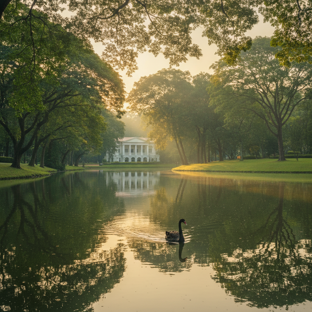
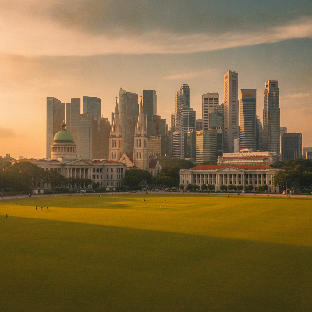
Singapore's Colonial Civic District, the area around the north bank of the Singapore River between Fort Canning Hill and Marina Bay, contains the densest concentration of British colonial-era public architecture in Southeast Asia: the neoclassical Supreme Court (1939) and City Hall (1929) buildings now converted to the National Gallery Singapore (the largest art museum in Southeast Asia), St Andrew's Cathedral (1862), Raffles Hotel (1887), The Padang (the colonial-era cricket ground at the center of civic Singapore), the Asian Civilisations Museum, the Cavenagh Bridge (1869, Singapore's oldest surviving bridge), and Fort Canning Hill (the site of the command post from which the British surrender of Singapore was ordered in 1942 — the most consequential act in Singapore's colonial history). The district represents the physical legacy of Sir Stamford Raffles's 1822 Town Plan, which divided Singapore into ethnic quarters and reserved the north bank of the river for government and European settlement.
Tiong Bahru: Singapore's Art Deco Neighbourhood
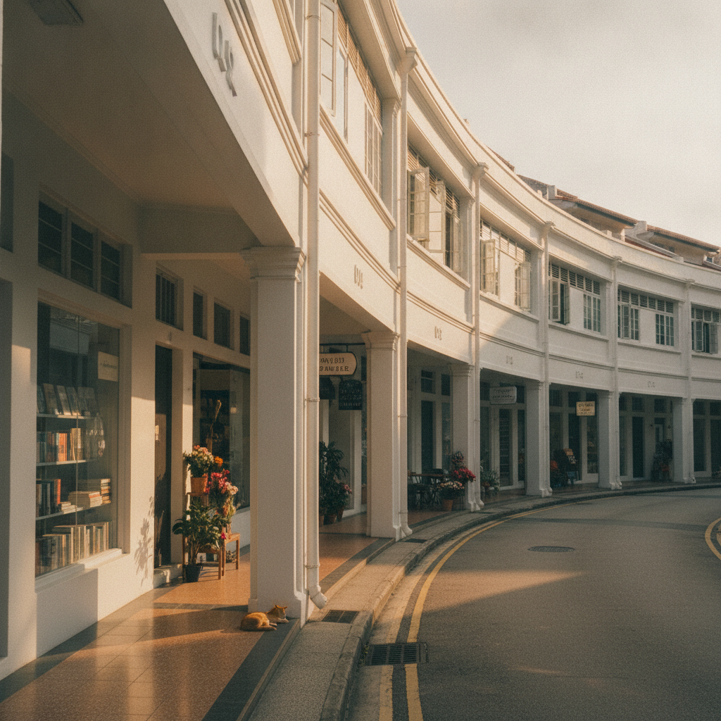
Tiong Bahru, the neighborhood approximately 2 kilometers southwest of Chinatown centered on Tiong Bahru Road, is Singapore's most architecturally distinctive pre-war residential neighborhood: the estate (a cluster of 55 blocks of flats and shophouses built between 1936 and 1954 by the Singapore Improvement Trust, the predecessor to today's Housing Development Board) is the finest surviving example of Streamline Moderne architecture in Southeast Asia — a style that arrived in Singapore via the British civil service's adoption of modernist housing design in the 1930s. The blocks' curved facades, rounded corners, spiraling staircases, and horizontal banding give the estate a distinctly aerodynamic quality that earned it the nickname 'the estate of the wealthy' in its early years, when its modern amenities (indoor plumbing, electricity, lifts) made it the most desirable public housing in Singapore. Tiong Bahru has undergone a second transformation since the 2000s, becoming Singapore's most creative and independent-business-heavy neighborhood.
Pulau Ubin: Singapore's Last Kampong
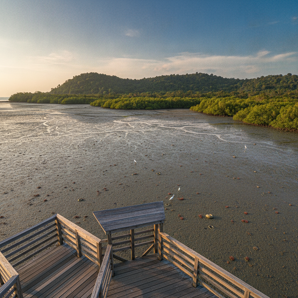
Pulau Ubin, a 10.2-square-kilometer island off the northeast tip of Singapore's mainland accessed by a 12-minute bumboat ride from Changi Point Ferry Terminal, is the last inhabited island off Singapore's coast and the only place in Singapore where the pre-development kampong (village) landscape survives: a landscape of secondary forest, mangrove swamps, coastal wetlands, granite quarries, and scattered Malay and Chinese kampong houses that has been largely unchanged since the 1970s, when Singapore's government froze development on the island pending a decision on its long-term use. The island has a permanent population of approximately 100 people (down from 3,000 in the 1980s), bicycle rental shops at the bumboat jetty, and no cars (the island's only vehicles are the National Parks Board trucks and the bumboat taxis). The Chek Jawa Wetlands (a 100-hectare coastal wetland on the island's eastern tip, containing six distinct ecosystems — mangrove forest, coastal forest, seagrass lagoon, sandy beach, rocky beach, and coral rubble) is one of the most biodiverse areas in Singapore, saved from development in 2001 by a successful last-minute public campaign against a planned land reclamation that would have destroyed the wetlands.
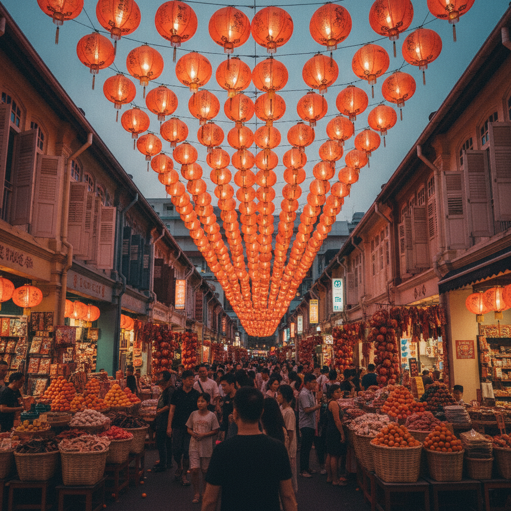
Chinatown and Tanjong Pagar: Singapore's Chinese Heritage Heart
Singapore's Chinatown, known in Hokkien as Niu Che Sui ('ox-cart water', after the ox-carts that transported water to the area in the 19th century), is the historic center of Singapore's Chinese community — the first settlement of Chinese migrants who began arriving in significant numbers after Sir Stamford Raffles established a British trading port in 1819. The district, bounded roughly by South Bridge Road, New Bridge Road, and the Singapore River, contains the city's most important Chinese temples, the best-preserved blocks of Straits Chinese shophouse architecture, Singapore's oldest Buddhist temple, and the Chinatown Complex hawker center (the largest hawker center in Singapore, with over 260 food stalls). Tanjong Pagar, the neighborhood immediately south of Chinatown, developed as Singapore's coolies' quarter and shipyard workers' district and now contains Singapore's most dramatic concentration of restored conservation shophouses alongside the Tanjong Pagar Railway Station (the former terminus of the Keretapi Tanah Melayu rail line to Malaysia, preserved as a heritage site after the line's closure in 2011).