Istanbul
Galata, Beyoğlu & İstiklal: Istanbul's European Soul
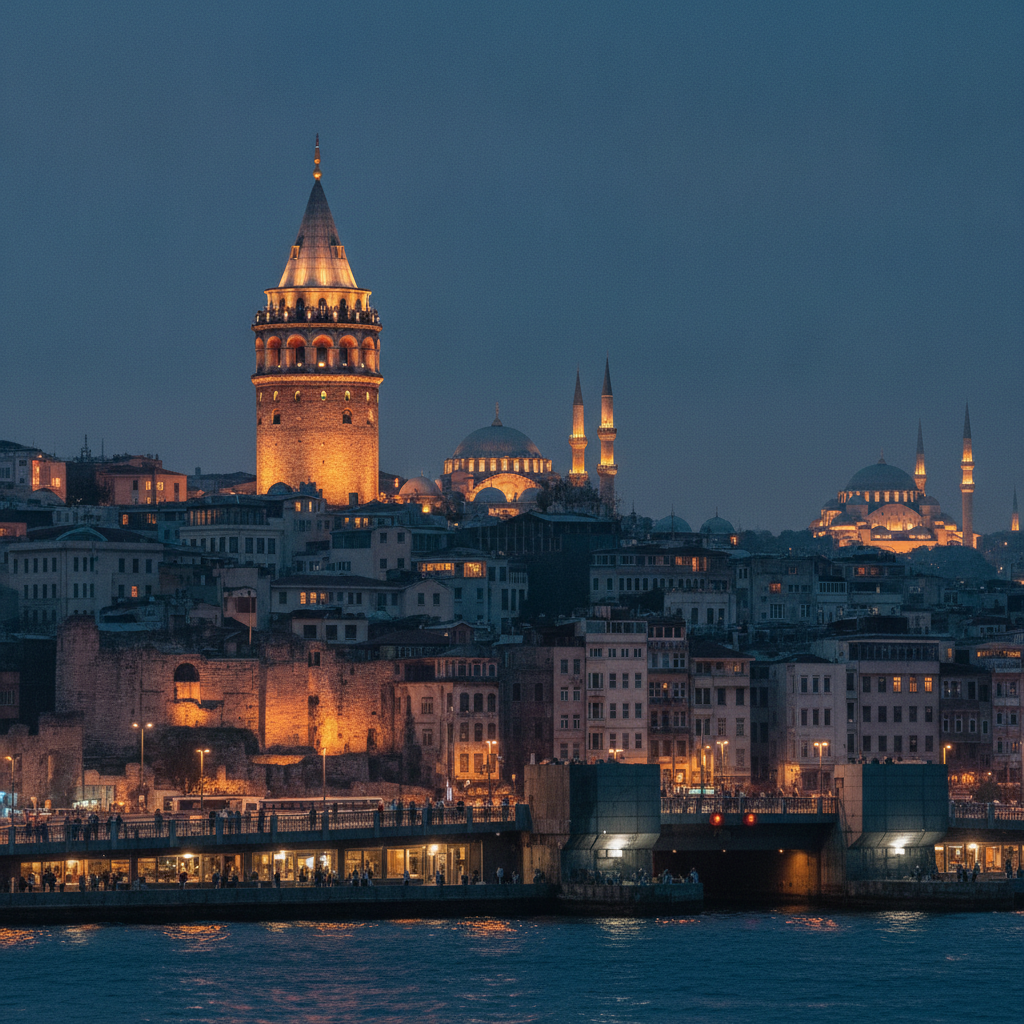
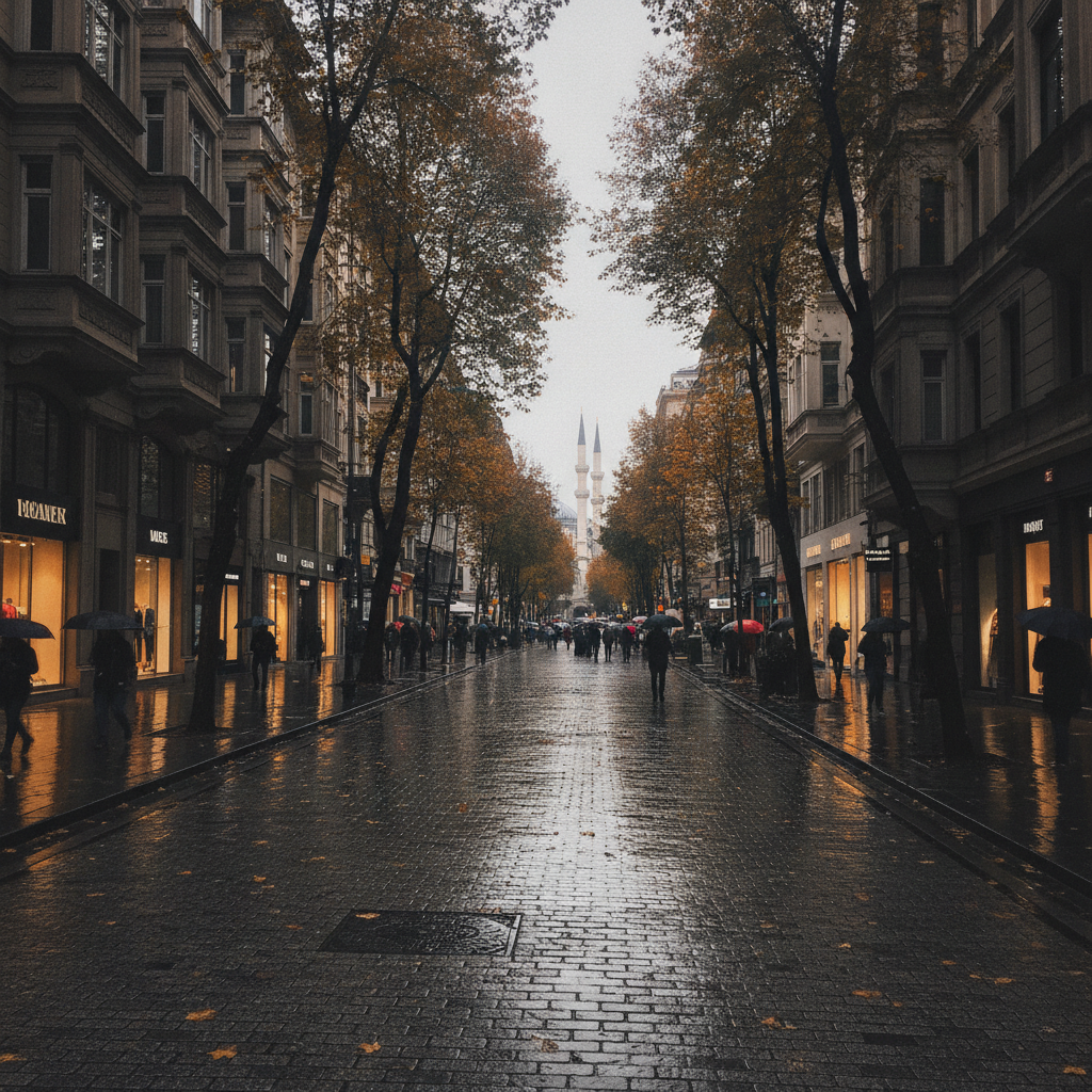
The Galata-Beyoğlu district, occupying the northern shore of the Golden Horn opposite Sultanahmet and rising steeply up the hill from the waterfront to the Taksim Square plateau, is Istanbul's historically non-Muslim and cosmopolitan quarter: a neighborhood that was the home of Genoese traders (who built the Galata Tower in 1348), Greek, Armenian, Jewish, and Levantine merchant families through the Ottoman centuries, European embassies and consulates in the 19th century, and today the center of Istanbul's arts, music, and nightlife scene. İstiklal Caddesi, the 1.4-kilometer pedestrianized main avenue connecting Tünel Square (bottom) to Taksim Square (top), is one of the busiest pedestrian streets in the world, with approximately 3 million people walking its length on weekend days.
Sultanahmet: The Historic Heart of Istanbul
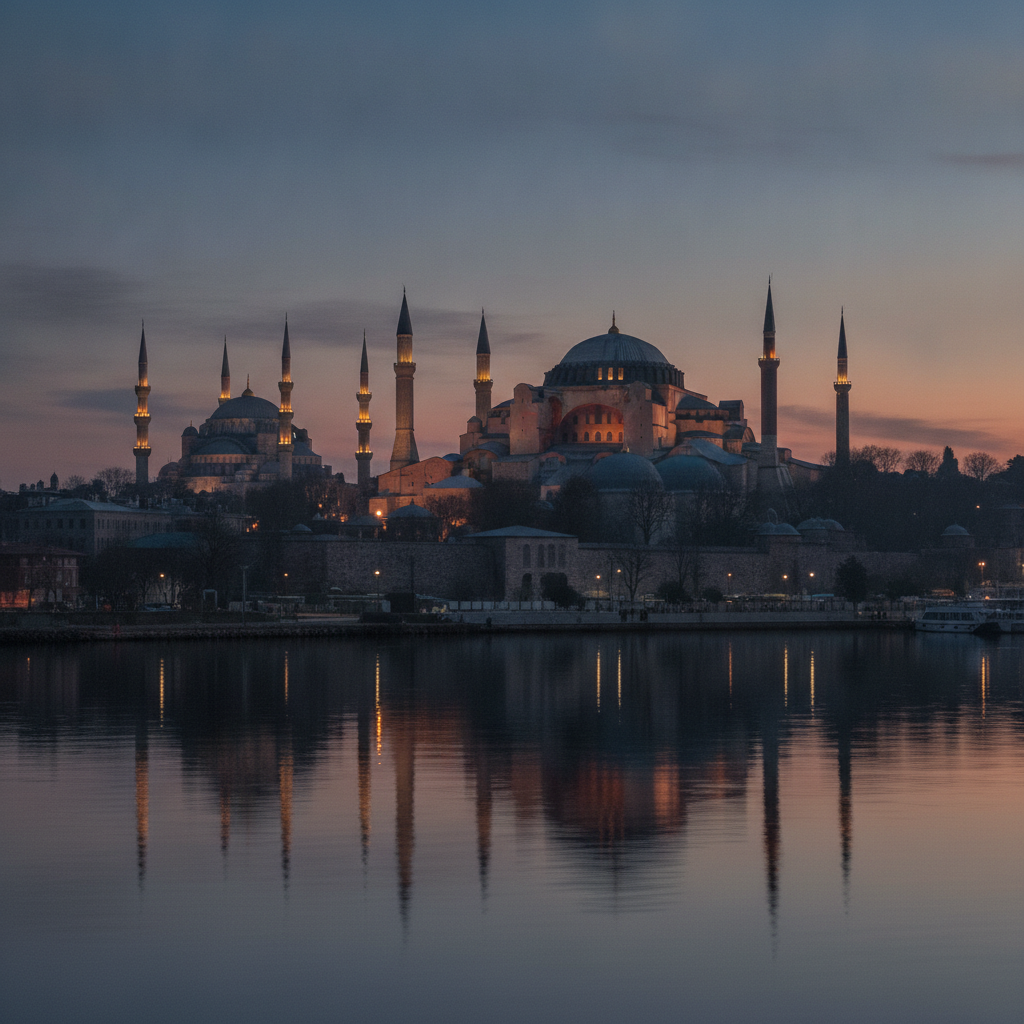
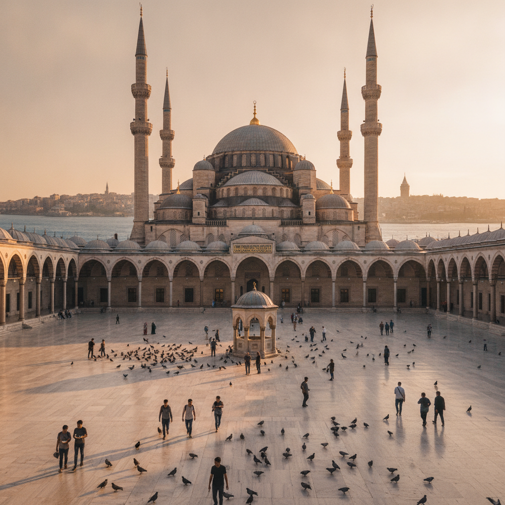
Sultanahmet, the historic peninsula district of Istanbul that occupies the tip of land between the Golden Horn and the Sea of Marmara where the original Byzantine city of Constantinople was built in 330 AD by Emperor Constantine I, contains the highest concentration of world-class monuments of any urban district in the world: within walking distance of one another are Hagia Sophia (the greatest surviving building of late antiquity, built in 537 AD by Emperor Justinian I), the Blue Mosque (the only mosque in Istanbul with six minarets, built 1609–1616 by Sultan Ahmed I), Topkapi Palace (the administrative and residential center of the Ottoman Empire for nearly 400 years, 1478–1853), the Basilica Cistern (the largest surviving Byzantine cistern, built 532 AD, capable of storing 80,000 cubic meters of water), and the Grand Bazaar (one of the world's oldest and largest covered markets, established 1461, with 4,000 shops in 61 covered streets).
Beşiktaş, Nişantaşı and Yıldız: Istanbul's Affluent European Quarter
The Beşiktaş–Şişli corridor, stretching north from the Bosphorus shore at Beşiktaş through the hillside neighborhoods of Nişantaşı, Teşvikiye, and Yıldız, is the most architecturally European and socially affluent district of modern Istanbul: a landscape of early 20th-century Beaux-Arts and neo-Ottoman apartment buildings, international luxury retail (Nişantaşı is Istanbul's equivalent of the 7th arrondissement in Paris or Knightsbridge in London), independent galleries, upscale restaurants, and two palace complexes (Dolmabahçe and Çırağan, both on the Bosphorus waterfront) connected by the forested hillside of Yıldız Park. The district is where Istanbul's old-money Turkish bourgeoisie and the international business community live, work, and socialize.
Princes' Islands: Istanbul's Car-Free Archipelago
The Princes' Islands (Adalar), a group of nine islands in the Sea of Marmara approximately 15–20 kilometers southeast of Istanbul's historic peninsula, are accessible by public ferry (50 minutes from Kabataş, operated by İstanbul Şehir Hatları) and are the only urban islands in the world that are simultaneously car-free (motor vehicles banned since the 19th century — only horse-drawn carriages and bicycles), within a major metropolitan area (Istanbul), and visually dominated by 19th-century wooden Victorian architecture (the villas and mansions built by Istanbul's Greek, Armenian, and Jewish merchant classes during the Belle Époque). The four largest islands — Büyükada (Big Island), Heybeliada, Burgazada, and Kınalıada — each have distinct characters and served historically as exile destinations for Byzantine princes (giving the archipelago its name), Ottoman officials, and — in the early Soviet period — Leon Trotsky, who lived in exile on Büyükada from 1929 to 1933.
Balat, Fener and the Golden Horn
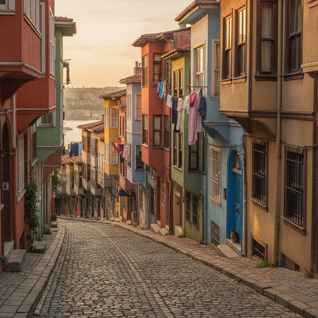
Balat and Fener, two adjacent neighborhoods on the southern shore of the Golden Horn on the western edge of the historic peninsula, are the most ethnically layered neighborhoods in Istanbul: Balat was the primary Jewish quarter of Istanbul from the 15th century (when Sephardic Jews expelled from Spain in 1492 were invited to settle by Sultan Mehmed II) until the mid-20th century; Fener was the headquarters of the Greek Orthodox Patriarchate (the Ecumenical Patriarchate of Constantinople, still the spiritual center of 300 million Orthodox Christians worldwide) and the primary residential area of Istanbul's Greek community for 500 years. Together they contain the most intact Ottoman-era residential streetscapes in Istanbul — a dense hillside of wooden Ottoman houses, Byzantine churches (several converted to mosques), the Chora Church (Kariye Mosque, containing the finest surviving Byzantine mosaics and frescoes outside Hagia Sophia), and the land walls of Theodosius II.
Fatih and the Faith Mosque: Conservative Istanbul
The Fatih district, occupying the central and western portions of the historic peninsula behind Sultanahmet, is Istanbul's most conservative and traditionally Muslim neighborhood: an area of working-class residential streets, small mosques and mescids (prayer rooms), religious schools, and the great Fatih Mosque complex (Fatih Camii — Faith Mosque), built by Sultan Mehmed II immediately after the Ottoman conquest of Constantinople in 1453 on the site of the Byzantine Church of the Holy Apostles (the second-most important church in Byzantium after Hagia Sophia). The surrounding neighborhoods — Vefa (famous for a 500-year-old boza shop), Şehzadebaşı (site of the Şehzade Mosque, Sinan's first major mosque commission), and Kumkapı (Istanbul's fish restaurant district on the Marmara shore) — form the Istanbul that existed before tourism.
Bosphorus Villages: Palaces, Fortresses, and the Strait
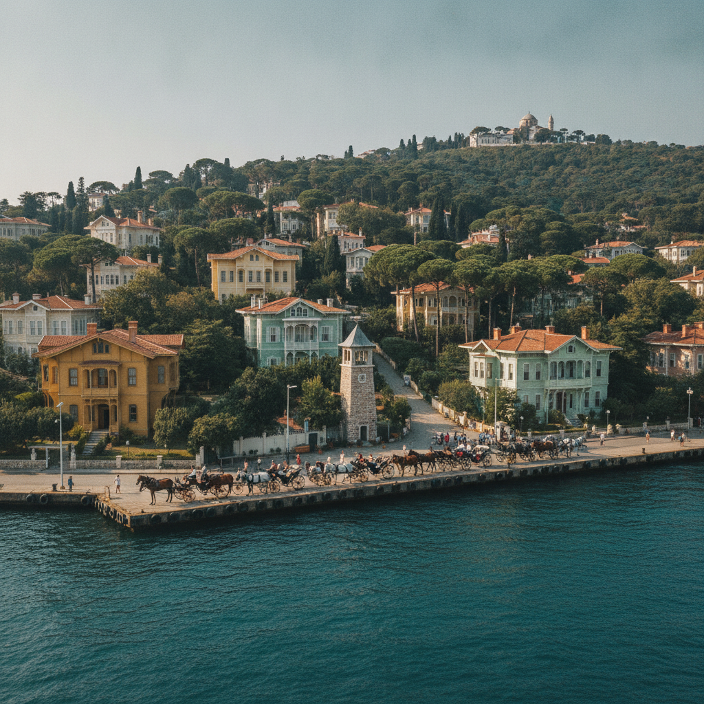
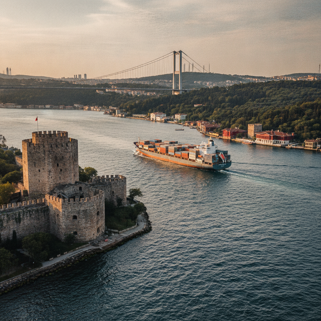
The European shore of the Bosphorus strait north of Beşiktaş, a 15-kilometer stretch of waterfront running from Dolmabahçe Palace to Sarıyer, is Istanbul's most aristocratic landscape: a continuous sequence of Ottoman palaces, 19th-century European-style villas (yalı), mosques, fishing villages, and forested hillsides that has attracted Istanbul's wealthy and powerful since the 15th century. The Bosphorus itself — 31 kilometers long, 700 meters to 3.5 kilometers wide, connecting the Black Sea to the Sea of Marmara — is one of the world's most strategically significant waterways, carrying approximately 50,000 ships per year including supertankers carrying Russian and Caspian oil to European markets. Walking, cycling, or taking the public bus along the Bosphorus shore road (the D100) between Beşiktaş and Sarıyer is the most atmospheric way to experience Istanbul's waterfront.
Asian Istanbul: Kadıköy, Üsküdar and the Other Shore
The Asian shore of Istanbul, accessed from the European side by the public ferry crossing (approximately 20 minutes, departing from Eminönü and Beşiktaş) or by the Marmaray tunnel (opened 2013, the world's first transoceanic railway tunnel, connecting Europe to Asia under the Bosphorus), contains approximately half of Istanbul's 15 million population and an entirely different urban character from the European side: less touristic, more residential, with neighborhoods like Kadıköy (a bohemian market district of independent bookshops, vinyl record stores, fish restaurants, and street food vendors), Üsküdar (a conservative, historically significant Ottoman neighborhood), and Moda (a seaside neighborhood of late 19th-century terraced houses, cafés, and ice cream shops), all facing the Bosphorus and the European skyline across the water.
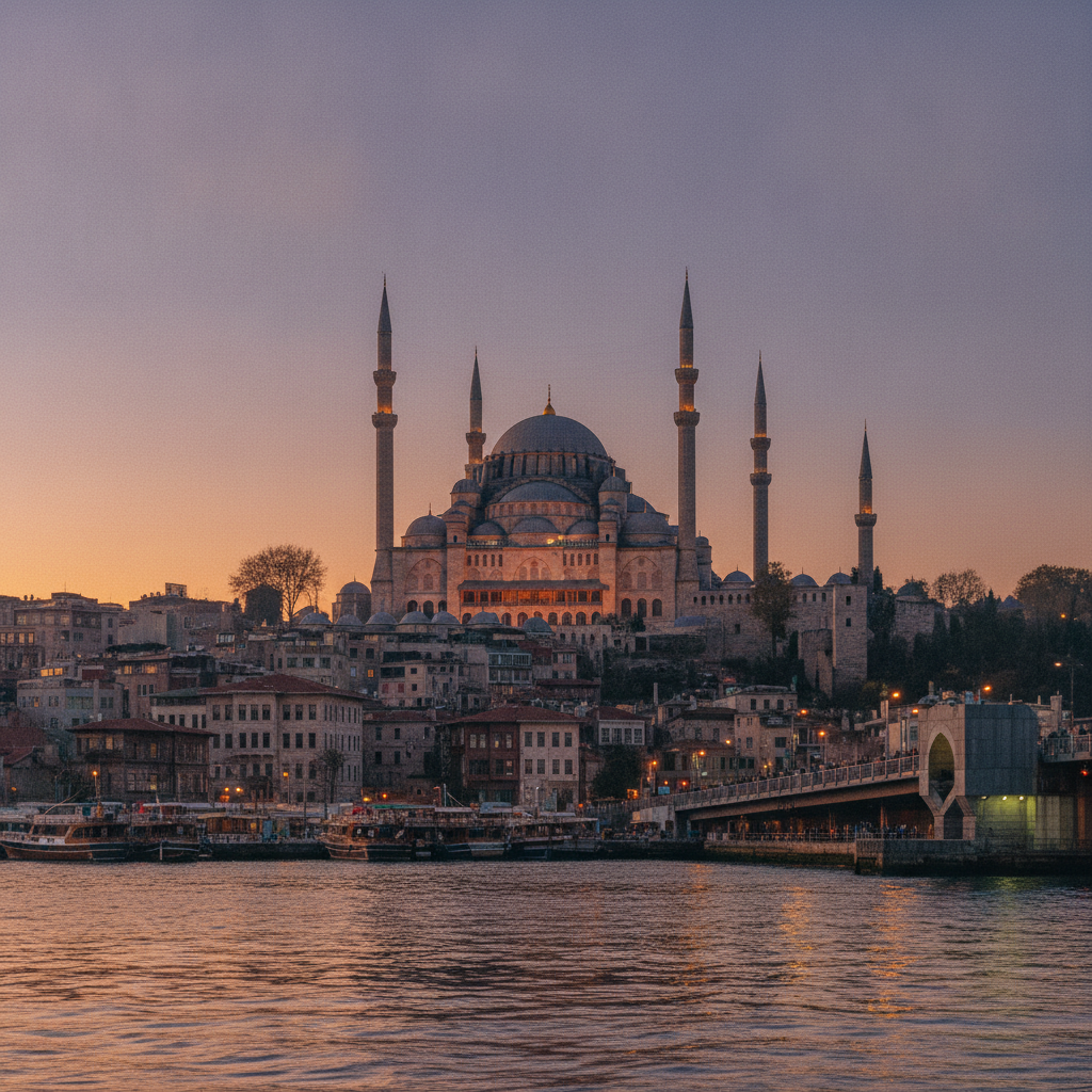
Süleymaniye and the Ottoman Old City
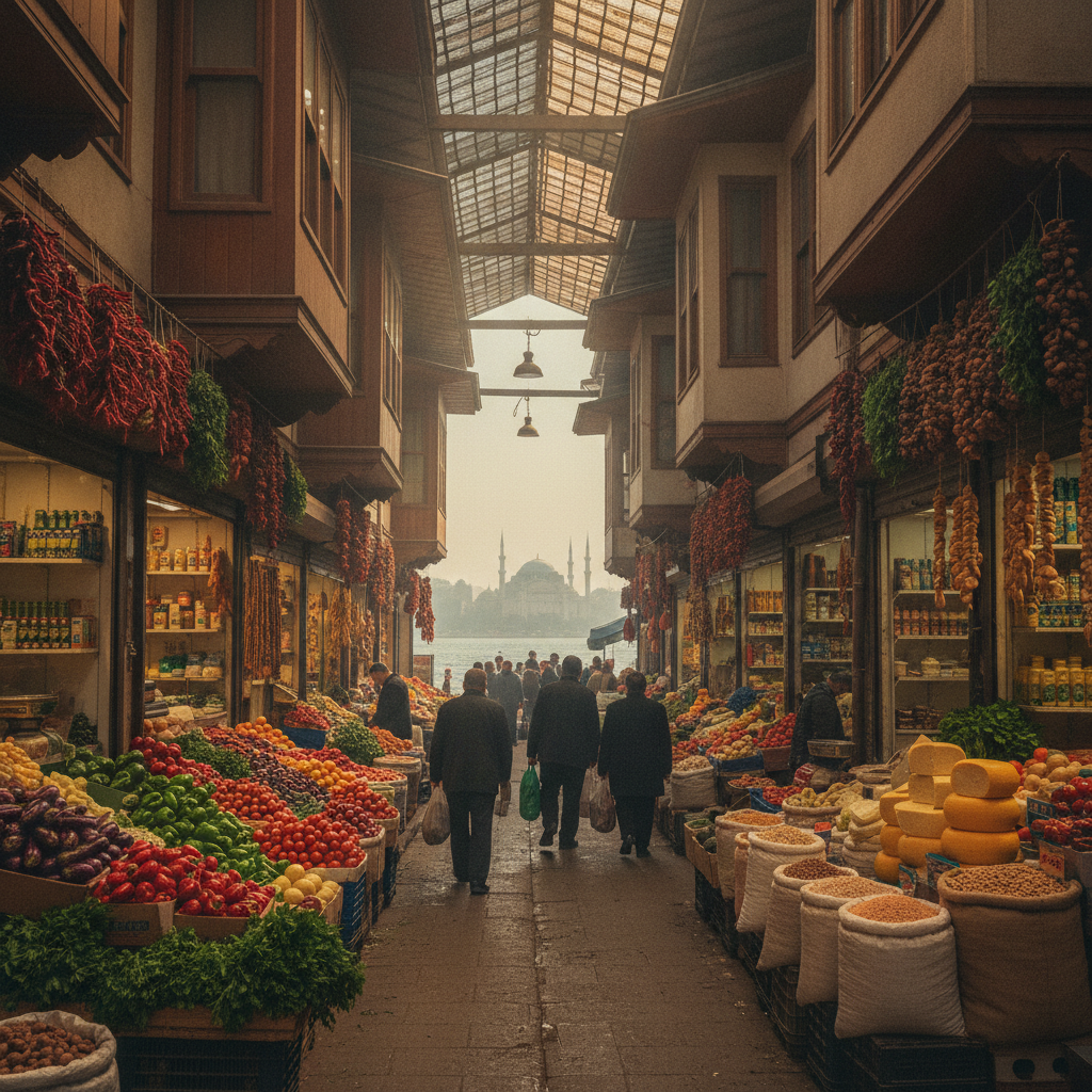
The Süleymaniye district, occupying the third and fourth hills of the historic peninsula immediately north and west of Sultanahmet, contains the densest concentration of Ottoman monumental architecture surviving anywhere in the world: the Süleymaniye Mosque complex (Mimar Sinan's masterwork, 1558), the Beyazıt Mosque (1506, the oldest surviving Ottoman imperial mosque in Istanbul), the Spice Market (Mısır Çarşısı, 1663), the Rüstem Pasha Mosque (1561, containing the finest Iznik tile interior in Istanbul), and the surrounding residential neighborhoods — Vefa, Zeyrek, Çarşamba — that retain the urban fabric of 16th and 17th-century Istanbul in their winding streets of wooden-framed Ottoman houses.