Barcelona
Pedralbes, Camp Nou & Sarrià: Barcelona's Quiet Upper City
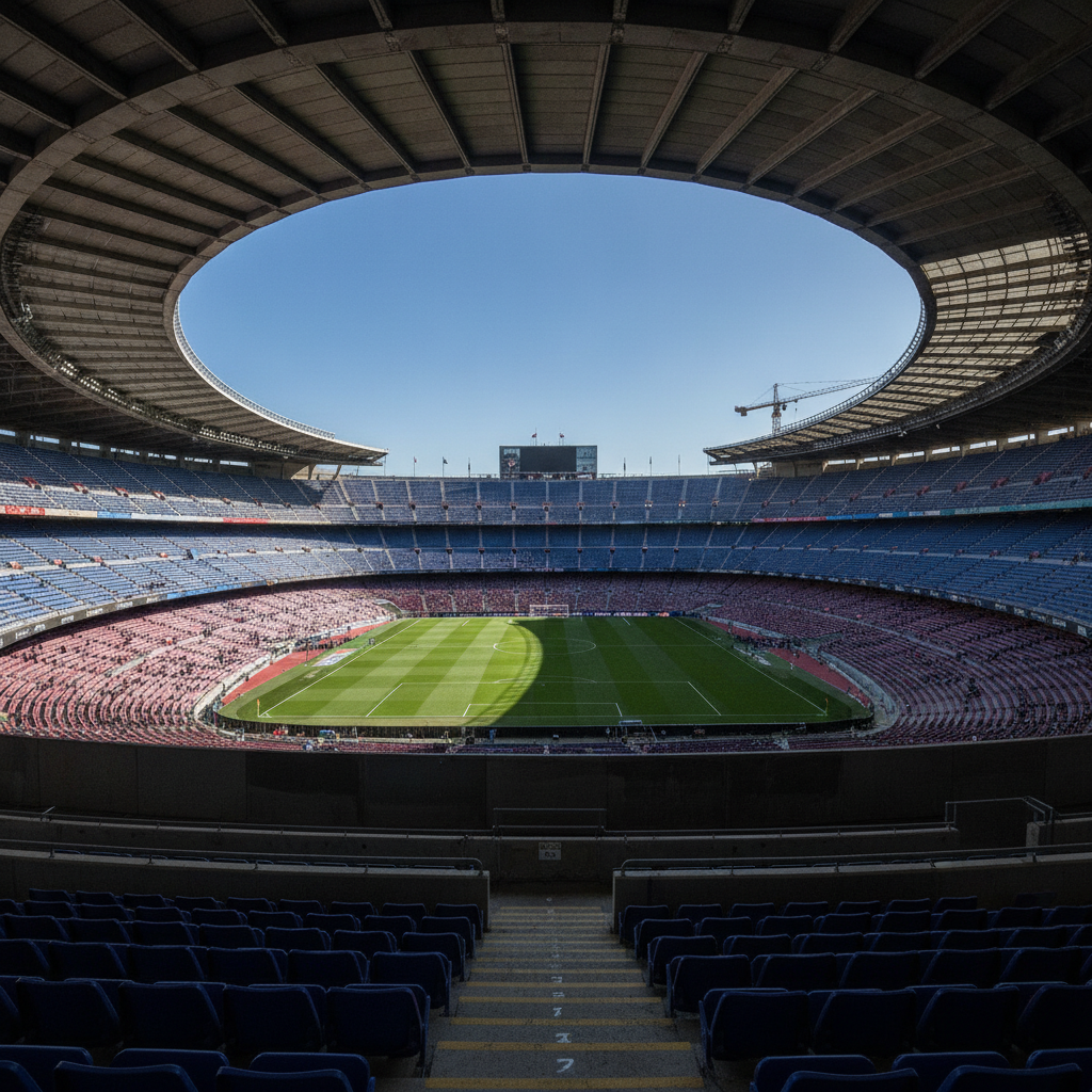
The upper-left quadrant of Barcelona — the neighborhoods of Pedralbes, Les Corts, Sarrià, and the zone along the Avinguda Diagonal beyond the Eixample — is the least-visited part of the city by tourists and the most revealing of how Barcelona's elite actually live. This is where the city's wealthiest families have always lived: in the Pedralbes neighborhood of early 20th-century villas and gardens, in the mansion zone around Sarrià, in the large apartments along the Diagonal. The route connects two of Barcelona's most significant but undervisited destinations — the Gothic monastery of Pedralbes (14th century, largely untouched) and the CosmoCaixa science museum (perhaps the best science museum in southern Europe) — with Camp Nou, the largest stadium in Europe, and the leafy residential streets that give this part of the city its particular character: prosperous, quiet, green, and emphatically Catalan.
Palau de la Música & Sant Pere: The Greatest Concert Hall in Spain and the City of Iron
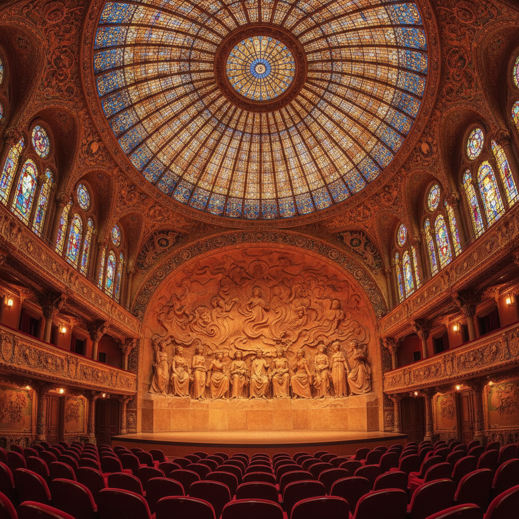
The neighbourhood of Sant Pere, between the Gothic Quarter and El Born, contains two of Barcelona's most extraordinary buildings — the Palau de la Música Catalana (1908) and the Mercat de Santa Caterina (2005) — as well as the old administrative center of the medieval city around the Arc de Triomf and one of Barcelona's most undervisited green spaces, the Parc de la Ciutadella. The Palau de la Música, a UNESCO World Heritage Site, is the only concert hall in the world lit entirely by natural light during the day; the Santa Caterina market is one of the finest examples of contemporary urban architecture in Spain.
Barceloneta & the Olympic Waterfront: From Columbus to the Mediterranean
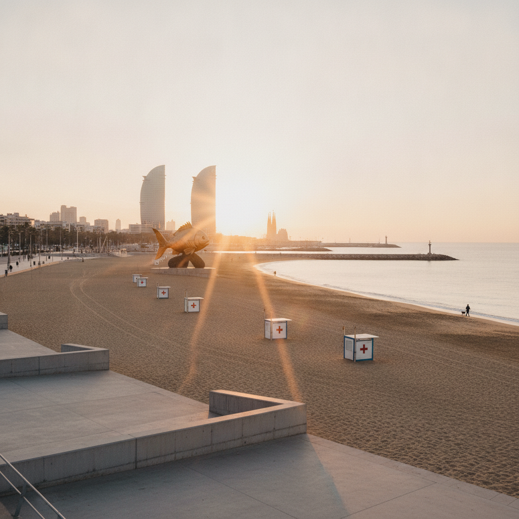
Barcelona's relationship with its own waterfront was, for most of its history, one of the great urban paradoxes of European cities: a Mediterranean port city in which the sea was functionally invisible to most residents, cut off by industrial railway lines, warehouses, and the working port infrastructure. The transformation of the 5-kilometer waterfront from the Columbus Monument to the Forum site — carried out principally for the 1992 Olympic Games — is one of the most successful urban renewal projects of the late 20th century, restoring to the city beaches, promenades, parks, and port facilities that had been severed from the urban fabric since the mid-19th century. This route follows the waterfront from the Port Vell (old port) through the 18th-century neighborhood of Barceloneta to the Olympic Village marina and back through the Parc de la Ciutadella.
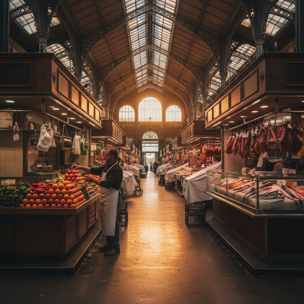
La Rambla, Boqueria & El Raval: The Street, the Market, and the Other Barcelona
La Rambla — the 1.2-kilometer pedestrian boulevard running from Plaça de Catalunya to the Columbus Monument and the sea — is simultaneously the most famous street in Spain and one of the most written-about urban spaces in the world. George Orwell described it in Homage to Catalonia (1938) as 'a wide tree-lined boulevard where the crowds are always thick' and 'the only street I have ever been in that I felt truly sorry to leave.' Today it is also one of the most pickpocketed streets in Europe. Adjacent El Raval, long Barcelona's most stigmatized neighborhood (historically the site of convents, the prison, a hospital for the poor, and a red-light district), has been dramatically transformed since the 1990s into a cultural district of the first order: MACBA, CCCB, the Filmoteca de Catalunya, and dozens of independent restaurants and galleries make it one of the most culturally dense neighborhoods in the city.
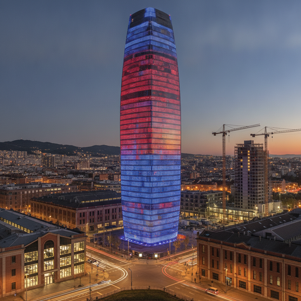
Poblenou, 22@ & the Design Hub: Barcelona's Creative Frontier
Poblenou — the Barcelona district bounded by the Eixample grid to the west, the sea to the south, and the Forum area to the north — was, from the 1840s through the 1980s, the industrial heart of Catalonia: a dense concentration of textile mills, chemical plants, metalworks, and factories that earned it the nickname 'the Manchester of Catalonia'. Its rapid deindustrialization in the 1980s–1990s left a vast landscape of brick factory buildings, empty lots, and working-class housing. The 2000 urban plan 22@ (the zip code of the former industrial zone, pronounced 'twenty-two at') launched one of Europe's most ambitious urban reinvention projects: converting 200 hectares of obsolete industrial land into a technology and creative district while retaining 20% of the housing stock and the neighborhood's social character. This route explores the result: contemporary architecture, innovative cultural institutions, and the traces of the industrial past that the transformation has preserved.
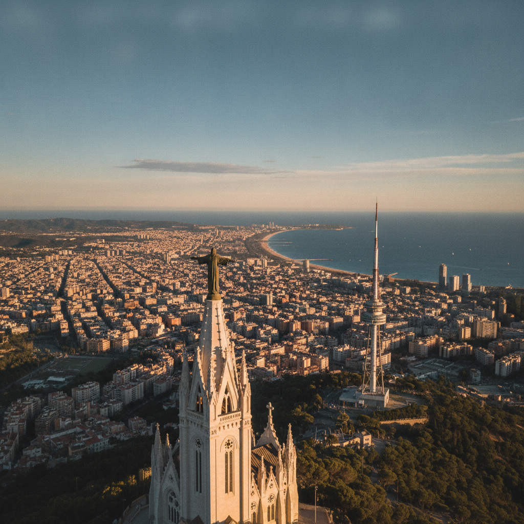
Tibidabo, Collserola & Pedralbes: Above the City, Beyond the Grid
The Serra de Collserola — the range of forested hills immediately behind Barcelona, rising to 512 meters at Tibidabo — is one of the most remarkable features of Barcelona's geography: a vast natural park of 8,295 hectares entirely within the metropolitan area, visible from every street in the city and yet mostly wilderness. Tibidabo, the highest point, takes its name from the Latin temptation of Christ ('all this I will give you', the words of the devil showing Christ the kingdoms of the world from a high mountain) — a name that fits perfectly a summit from which the entire city, its harbor, and the Balearic Islands on a clear day are visible. This route ascends to Tibidabo, crosses the ridge to the Torre de Collserola, descends through the park to the medieval monastery of Pedralbes, and ends at the palatial gardens of Palau Reial.
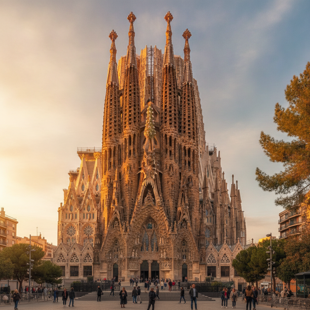
Sagrada Família to Arc de Triomf: Gaudí's Masterwork and the Eixample Grid
The Eixample ('enlargement') district, designed by engineer Ildefons Cerdà in 1860 and built over the following century, is one of the most remarkable examples of urban planning in European history: a perfect grid of octagonal city blocks (the chamfered corners creating the wide intersections that give the district its distinctive aerial pattern), each block originally intended to contain interior gardens accessible to residents. Within this rational grid, Catalan Modernisme erupted in the late 19th and early 20th centuries, placing some of the most extravagant architecture ever built in Europe on the same street corners. This route connects the two defining landmarks of the district — the Sagrada Família and the Manzana de la Discordia (Block of Discord) on Passeig de Gràcia — via the Hospital de Sant Pau, Gaudí's La Pedrera, and the civic heart of Plaça de Catalunya.
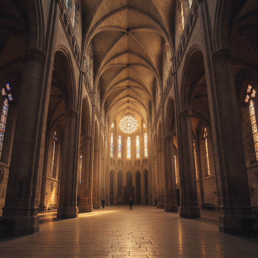
Gothic Quarter & El Born: Roman Ruins to the City of the Sea
The Barri Gòtic (Gothic Quarter) is one of the largest and best-preserved medieval city centers in Europe — though 'preserved' understates what is actually a complex history of survival, adaptation, demolition, and creative reconstruction. The Roman colony of Barcino (founded 10–15 BC) underlies the medieval city; its ruins lie beneath Plaça del Rei and the Cathedral. The medieval Catalan-Aragonese Crown (12th–15th centuries) made Barcelona the commercial capital of the western Mediterranean, building the Cathedral, the royal palace complex, and the sea-facing quarter of La Ribera (now El Born). This route moves through 2,000 years of urban sediment from the Cathedral to the extraordinary Gothic hall of Santa Maria del Mar and the 19th-century iron market of El Born.
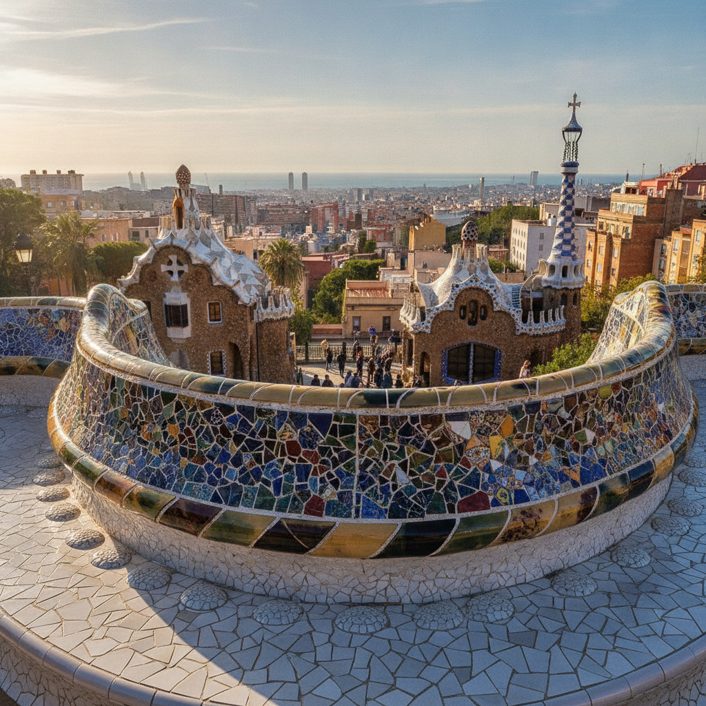
Park Güell & Gràcia: Gaudí's Urban Garden and Barcelona's Village Within
Park Güell occupies the southern slope of the Carmel hill in the district of Gràcia, overlooking the city and the sea. It was conceived by Eusebi Güell (Gaudí's principal patron) as a garden city of 60 plots, inspired by the English garden-city movement — a hillside suburb for Barcelona's upper classes. Only 2 of the 60 plots were ever sold (one to Gaudí himself, who lived there 1906–1926), and in 1922 the failing project was donated to the city as a public park. What remained — Gaudí's extraordinary structures (gatehouses, Dragon Staircase, Hypostyle Hall, the great terrace) and the landscaped pathways — became one of the defining public spaces of 20th-century Barcelona. The neighborhood of Gràcia below (an independent municipality until its annexation by Barcelona in 1897) retains a distinct village identity with its own festivals, politics, and local culture.
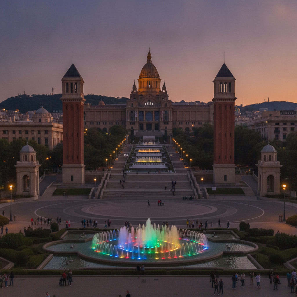
Montjuïc & Poble Sec: Olympic Hill, Mies van der Rohe, and the City of Gardens
Montjuïc — the hill rising 184 meters on the southwestern edge of Barcelona between the port and the Llobregat delta — has been, at different points in its history, a Jewish cemetery (hence the likely etymology of 'mountain of Jews'), a military fortress controlling the city below, the site of two world's fairs (1888 preparatory works, 1929 main site), the location of the 1992 Olympic stadium and athletics events, and the city's main cultural hill, containing the Museu Nacional d'Art de Catalunya, the Fundació Joan Miró, and the Teatre Grec. This route climbs Montjuïc from the Plaça d'Espanya, crosses the hill via its main cultural institutions, reaches the fortress at the summit, and descends to the tapas street of Poble Sec.