Bukittinggi Sianok Canyon & Ngarai Walk
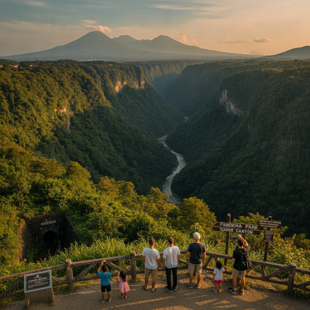
Explore the dramatic Sianok Canyon — the 15km gorge carved by the Sianok River through the volcanic plateau on which Bukittinggi stands drops nearly 100 metres below the city, with trails along the canyon floor through rice terraces, coconut groves, and traditional villages accessible by foot from the city rim.
- 1
Canyon Rim Viewpoint
The canyon rim at Taman Panorama provides the panoramic view that gives the park its name — the Sianok Canyon (Ngarai Sianok) stretches into the distance from this vantage point, with the layered green of the rice terraces and forest on the canyon floor contrasting with the near-vertical walls of volcanic tuff that drop from the city edge to the river below. The view is most dramatic in early morning when the canyon is still in shadow and mist fills the bottom before the sun reaches the floor, and again at sunset when the western light illuminates the canyon walls.
- 2
Descent to Canyon Floor
The trail descending from the Bukittinggi rim to the Sianok Canyon floor is a 30-minute hike down steep switchbacks through forest — the descent passes through the geological layers of the volcanic tuff formation and arrives at the canyon floor in a dramatically different microclimate than the city above, cooler and more humid, surrounded by the near-vertical walls. The canyon floor path follows the Sianok River through a landscape of coconut palms, banana groves, and the rice terraces cultivated by the villages of Koto Gadang and Sianok accessible through the canyon.
- 3
Koto Gadang Silver Village
Koto Gadang village at the end of the Sianok Canyon walk is famous as the birthplace of Minangkabau silversmithing — the village that has produced Indonesia's most skilled silver craftsmen for generations, including the families whose filigree silver work adorns the national museum in Jakarta, maintains active workshops where the traditional techniques of silver wire manipulation, granulation, and repousse are still practised. The village has also produced an extraordinary number of Indonesia's intellectual and political leaders, a fact explained by the Minangkabau rantau tradition that sends young men out into the world to accumulate education and experience.
- 4
Canyon Rice Terraces
The rice terraces carved into the Sianok Canyon floor and lower walls demonstrate the intensive agricultural system that has sustained Minangkabau communities in this highland terrain for centuries — the sawah (wet rice) cultivation in the canyon using the Sianok River for irrigation creates a productive agricultural system in a location that would otherwise be too steep for cultivation. The terraces, maintained by the families of the canyon villages, are most visually spectacular during the planting season when the water-filled terraces reflect the sky, and during the harvest when the golden rice awaits cutting.
- 5
Japanese Tunnel System
The Lobang Jepang (Japanese Hole) tunnel system beneath Bukittinggi was excavated during the Japanese occupation (1942-1945) using forced labour from the local population — the 1500-metre network of underground tunnels used as military headquarters, weapons storage, and shelter from Allied air attack is now open to visitors as a testament to the wartime occupation. The construction of these tunnels at the cost of significant local suffering is one of the defining historical experiences of Bukittinggi's population during the Japanese period.
- 6
Canyon Exit Koto Gadang Bridge
The bridge connecting Koto Gadang with the road back to Bukittinggi marks the end of the canyon walking circuit — the return journey up from the canyon floor to the city level involves either retracing the descent route or the longer road walk, and the transition from the enclosed, intimate canyon environment back to the open city plateau with its views of the Minangkabau highlands provides a physical summary of Bukittinggi's remarkable topographical position at the edge of the canyon that makes it one of the most dramatically situated cities in Sumatra.
Walk this route with audio
Stories play automatically as you reach each stop — no tapping needed.
More in Bukittinggi
Bukittinggi Surrounding Villages & Batusangkar Walk
Bukittinggi Merapi & Singgalang Volcano Walk
Bukittinggi Dutch Colonial & Padri War History Walk
Bukittinggi Minang Food & Padang Cuisine Walk
Bukittinggi Market Day & Highland Commerce Walk