Tulum Maya Ruins on the Caribbean Cliff Gran Cenote Sian Kaan Biosphere and the Beach Town That Became the Worlds Most Instagrammed Destination and Its Own Ecological Crisis
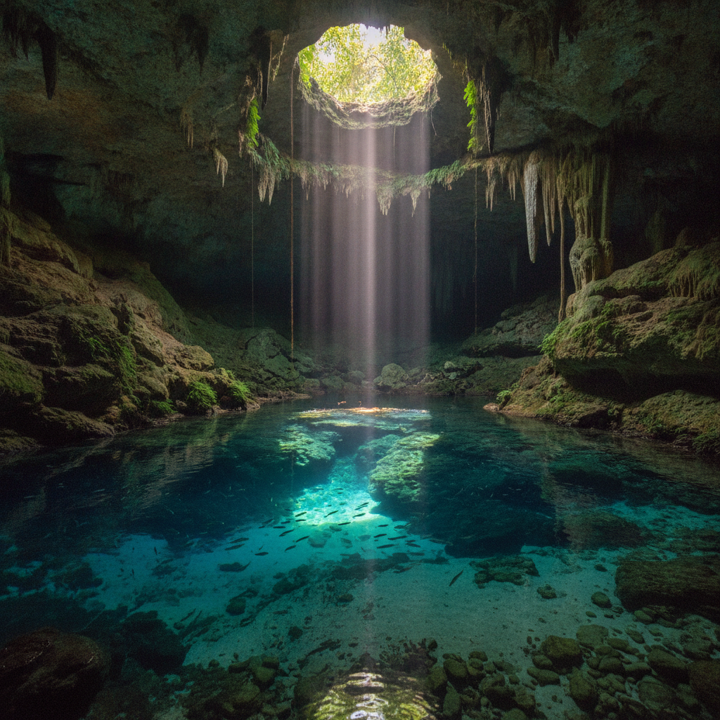
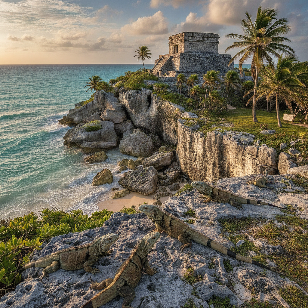
Tulum occupies the most dramatically situated Maya archaeological site in Mexico, a walled ceremonial city built on a limestone cliff above the turquoise Caribbean at the moment when the Classic period Maya civilization was transitioning to the post-Classic maritime trade economy of the Yucatan coast, and whose silhouette of the Castillo pyramid against the sea has become one of the most reproduced images in global travel photography. The archaeological site of Tulum, active from approximately 1200 to 1550 CE as a trading port and religious center serving the coastal route between the Gulf Coast and the Bay of Honduras, is smaller and less monumentally impressive than the inland Maya sites of Chichen Itza or Uxmal, but its combination of cliff-top setting, Caribbean backdrop, and the resident iguanas sunning on the temple stones creates an atmosphere that no other archaeological site in Mexico replicates. Below the ruins, the beaches of Tulum arc north and south along a coast where the limestone platform meets the Caribbean, with the cenotes, the sinkholes in the limestone platform that provide access to the underground freshwater river system of the Yucatan aquifer, scattered through the hotel zone and the jungle behind the beach. The Gran Cenote, 4 kilometres from Tulum town on the road to Coba, is the most visited cenote in the Tulum area, with stalactite-hung chambers, underwater tunnels, and the crystal clarity of the aquifer water that the cenote system preserves. The Sian Kaan Biosphere Reserve, the UNESCO World Heritage protected area covering 528,000 hectares of coastal lagoon, mangrove, tropical forest, and marine reef south of Tulum, contains the highest biodiversity concentration on the Caribbean coast of Mexico and represents the ecological baseline against which the destruction of the tourist economy can be measured.
- 1
Tulum Archaeological Site and the Descending God
The Tulum archaeological site, the walled Maya city on the cliff above the Caribbean at the northern end of the Tulum hotel zone, is the most visited Maya site in Mexico in terms of daily visitor numbers, surpassing even Chichen Itza on peak days, due to its proximity to the Cancun hotel zone and the photogenic combination of ancient stones, turquoise sea, and the daily parade of cruise ship passengers who reach the site by chartered transport from Playa del Carmen and the Cozumel ferry port. The site was an active port town from approximately 1200 CE through the early colonial period, serving the coastal trade route that carried cacao from the Tabasco coast, obsidian from the Mexican highlands, copper bells from the southwest, and the luxury goods of the late post-Classic trade network through the walled ceremonial compound that served as both a trading station and a religious center. The Castillo, the main pyramid of Tulum positioned at the cliff edge above a small beach where turtles nest, is the building that appears in the iconic photograph of the site, and whose interior contained a shrine to the Descending God, the inverted figure deity associated with the setting sun and the planet Venus who appears repeatedly in the Tulum architecture and whose meaning and identity continues to be debated by Maya scholars. The Temple of the Frescoes, the two-story structure that preserves the finest surviving Tulum murals in its interior niches and exterior friezes, depicts the Descending God flanked by agricultural fertility deities in a stylistic tradition that connects Tulum to the Mixtec-influenced painting tradition of the late post-Classic period. The stone wall enclosing the site on its three landward sides, the only Maya site with a complete defensive perimeter wall, documents the political insecurity of the post-Classic period when the breakdown of the larger political units of the Classic period left coastal trading cities needing physical defense against rival communities.
- 2
Gran Cenote and the Yucatan Underground River System
The Gran Cenote, located 4 kilometres west of Tulum town on the road to the Coba archaeological site, is the most photographed and most visited cenote in the Quintana Roo state, with a main open-air chamber of approximately 60 metres diameter connected to underwater stalactite passages that extend several hundred metres into the aquifer system that underlies the entire Yucatan Peninsula. The Yucatan Peninsula has no surface rivers: all freshwater flows through the underground limestone aquifer that was dissolved by millions of years of rainwater percolation, creating the world's largest system of subterranean rivers and the cenote sinkholes that provide access to this underground world at the points where the limestone ceiling has collapsed. The Gran Cenote freshwater clarity, maintained at visibility of 20 to 50 metres by the natural filtration of the limestone rock and the limited input of surface nutrients, creates the snorkeling and scuba diving environment that makes the cenote circuit one of the premier cave diving destinations in the world, with the Sistema Dos Ojos and the Sistema Sac Actun cenote systems connecting Gran Cenote to an underwater network extending over 300 kilometres in total surveyed length. The cenote system of the Tulum area is under severe ecological pressure from the tourist economy that depends on it: an estimated 1,000 or more swimmers per day in the peak season at Gran Cenote alone introduce sunscreen chemicals, body lotion residues, and the microbial load of human contact into the pristine aquifer water, and the hotels and residential developments of the Tulum hotel zone discharge their wastewater into the same aquifer that the cenotes access. The oxybenzone and octinoxate in conventional sunscreens, demonstrated to damage coral reefs at concentrations of one part per trillion, are now present in the Tulum cenote water at concentrations several orders of magnitude higher.
- 3
Sian Kaan Biosphere and the Coastal Ecology
Sian Kaan, meaning Where the Sky is Born in Yucatec Maya, is the UNESCO World Heritage biosphere reserve covering 528,000 hectares of the Caribbean coast south of Tulum, protecting the largest protected area on the Mexican Caribbean coast and containing within its boundaries tropical forest, freshwater and saltwater lagoons, mangrove ecosystems, coral reef, and the archaeologically significant canal network that the Maya constructed through the coastal lagoons to facilitate the trade canoe traffic of the post-Classic maritime economy. The Sian Kaan wildlife includes jaguars whose population in the reserve is estimated at 50 to 80 individuals, manatees in the coastal lagoons, sea turtles nesting on the Caribbean beaches from May through October, saltwater crocodiles in the mangrove channels, and 339 recorded bird species including the roseate spoonbill, the jabiru stork, and the full complement of Caribbean coastal waterbirds. The boat tour of the Sian Kaan Bahia de la Ascension, operated by the community ecotourism cooperative from the village of Punta Allen at the end of the 60-kilometre dirt road through the biosphere, provides access to the flamingo colonies, the manatee feeding areas, and the Maya canal float trip that has become the primary tourism product of the reserve. The Muyil archaeological site within the Sian Kaan reserve, accessible by boat through the lagoon channels from the Chunyaxche landing, presents the Late Classic period Maya ceremonial center connected to the coastal trade route by the canal system, in a jungle setting that the absence of tourist infrastructure maintains at a level of atmospheric isolation impossible at the coastal Maya sites. The ecological boundary between Sian Kaan and the Tulum hotel zone is the most dramatic conservation frontier in Mexico, where the tourist development of the hotel zone has advanced to within meters of the biosphere reserve boundary.
- 4
Tulum Cenote Dos Ojos and Cave Diving
The Cenote Dos Ojos, named for its two connected openings that resemble eyes when viewed from above, is one of the entrances to the Sistema Dos Ojos cave system, one of the longest underwater cave systems in the world with over 85 kilometres of surveyed passages connecting the Dos Ojos cenotes to the Caribbean coast and to the Sistema Sac Actun to the north. The cave diving community of the Tulum area, concentrated in the dive shops of the Tulum hotel zone and the Akumal village north of Tulum, uses the Dos Ojos cenotes as the primary access point for the technical cave diving that the Sistema Sac Actun enables, with dives requiring full cave diving certification and the redundant equipment systems that the zero-visibility accident risk of cave diving demands. The snorkeling circuit of Dos Ojos, in which non-certified swimmers follow the marked routes through the open-water chambers of the cenote system, provides access to the stalactite formations and the halocline, the visible boundary between the fresh aquifer water and the denser saltwater intrusion from the Caribbean, without the training requirements of the full cave dive. The archaeological significance of the cenote cave systems was dramatically demonstrated in 2018 when underwater archaeologist Guillermo de Anda discovered that the Sistema Sac Actun contains the largest concentration of underwater Maya archaeological material in the world, including human skeletal remains, ceramics, and extinct megafauna bones that document human presence in the caves dating back 13,000 years. The connection between the cenotes and the Maya ritual tradition, in which the cenotes were sacred portals to the underworld Xibalba where the rain god Chaac resided and where human sacrifices were deposited to petition for rain, is documented at the Sacred Cenote of Chichen Itza and in the smaller-scale offerings found in cenotes throughout the Yucatan Peninsula.
- 5
Coba Ruins and the Jungle Pyramid
Coba, the Late Classic period Maya city 50 kilometres northwest of Tulum in the Quintana Roo jungle, contains the Nohoch Mul pyramid that at 42 metres is the tallest Maya pyramid in the Yucatan Peninsula and the only major pyramid in Mexico from which climbing was prohibited in 2021 following a series of accidents in which the steep angle, the worn steps, and the lack of handholds created dangerous conditions for the tourist volume visiting the site. The Coba archaeological site, excavated only partially despite decades of INAH work, covers an area of 80 square kilometres of jungle containing an estimated 6,500 structures connected by the sacbe causeways, the white stone roads that the Maya constructed between cities and to the cenotes that served as water sources for the inland jungle communities. The sacbe road network of Coba is the most extensive Maya road system in the peninsula, with the longest sacbe extending 100 kilometres west to the site of Yaxuná in Yucatan state, demonstrating the political reach of the Coba polity at the height of its Classic period power in the 6th through 9th centuries. The Coba jungle provides the contrast to the Tulum cliff site that makes the combined one-day visit the standard tourist itinerary for the Riviera Maya cultural circuit: Tulum offers the Caribbean backdrop, Coba offers the jungle immersion and the tall pyramid viewpoint. The bicycle rental at the Coba site entrance, allowing visitors to cycle the 2-kilometre sacbe road from the entrance to the main pyramid complex through the jungle, is the practical solution to the distance that the sprawling site presents, and gives the Coba visit an active physical dimension that the Tulum ruins and the cenotes also emphasize.
- 6
Tulum Hotel Zone and the Ecological Crisis
The Tulum hotel zone, the 12-kilometre strip of boutique hotels, beach clubs, yoga retreats, and wellness establishments that lines the Caribbean coast south of the archaeological site, is the most discussed sustainability failure in Mexican tourism, a destination that positioned itself as an eco-luxury alternative to the mass tourism of Cancun and Playa del Carmen and has instead produced a set of ecological crises that threaten the cenote water quality, the coral reef ecosystem, and the natural landscape that the tourist product depends on. The hotels of the Tulum zone, many of which operate without connection to the municipal sewage system that does not extend through the full length of the hotel zone, dispose of their wastewater through underground injection wells that discharge directly into the aquifer, resulting in the fecal coliform contamination of the cenote water and the coral reef that coastal water testing has documented repeatedly since 2018. The sargassum crisis of the Caribbean coast, in which the massive brown algae blooms that began in 2015 have deposited on Tulum beaches in quantities that overwhelm the manual removal capacity of the hotel cleaning crews, producing hydrogen sulfide gas as the sargassum decomposes and creating the smell and visual degradation that affected beach quality at Tulum severely from 2018 through the early 2020s. The real estate speculation that followed the global publicization of Tulum on social media drove land prices in the hotel zone from a few thousand to millions of dollars per hectare in a decade, attracting investment from organized crime and from international real estate funds that have purchased and developed the hotel zone at a rate the local authority infrastructure and environmental regulation cannot match. The gap between the eco-luxury branding of Tulum, built on images of Boho-style beach clubs in jungle settings, and the ecological reality of inadequate sewage treatment, cenote contamination, and reef damage constitutes the central sustainability contradiction of the most Instagrammed destination in Mexico.
Walk this route with audio
Stories play automatically as you reach each stop — no tapping needed.
More in Tulum
Tulum Riviera Maya Circuit Akumal Xel-Ha Xcaret and the Full Caribbean Coast Experience From the Cancun Hotel Zone to the Sian Kaan Biosphere Reserve
Tulum Practical Guide Getting There Transport Budget Safety and How to Visit the Riviera Maya Without Paying New York Prices for Mexican Beach Sand
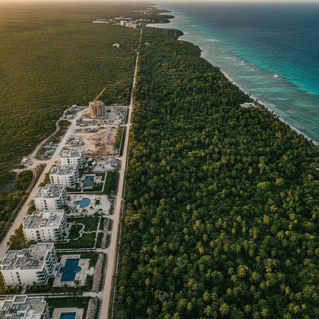
Tulum Real Estate Speculation Narco Investment Organized Crime and the Political Economy of How the Most Beautiful Beach in Mexico Was Sold to Money Launderers Hedge Funds and Instagram Influencers
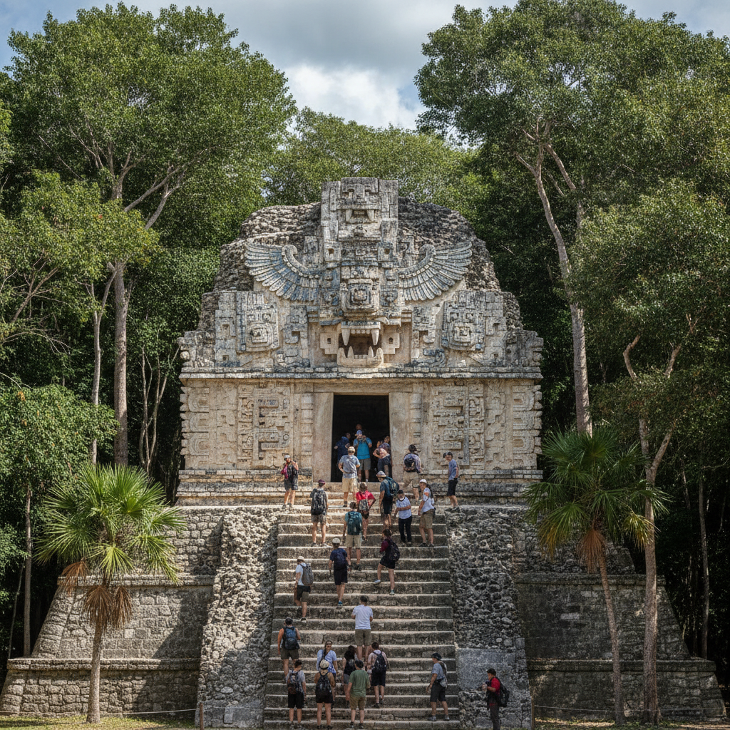
Tulum Maya Heritage Valladolid Chichen Itza Ek Balam and the Post-Classic Coastal Trade Network That Connected the Caribbean to the Heart of Mesoamerica
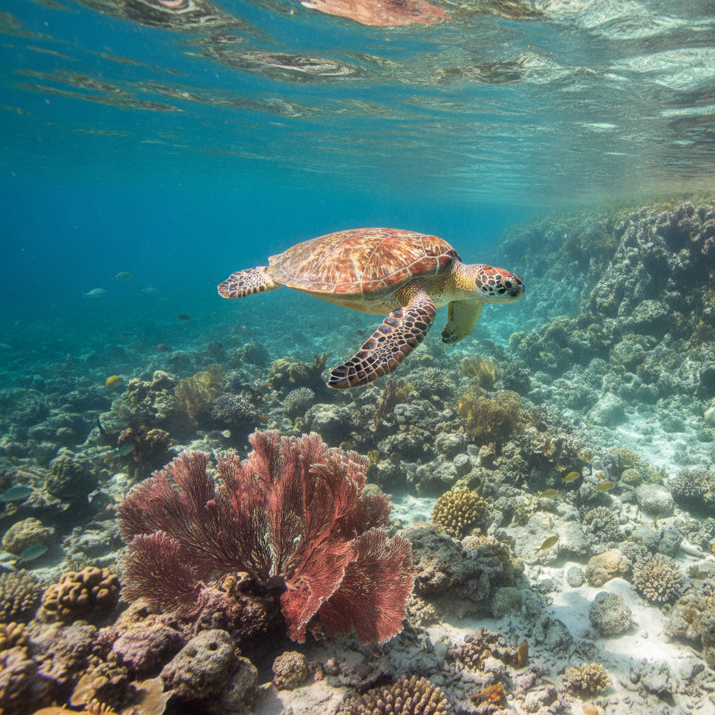
Tulum Sea Turtles Coral Reef Manatees Jaguars and the Caribbean Marine Ecosystem That Surrounds the Worlds Most Photographed Beach Town