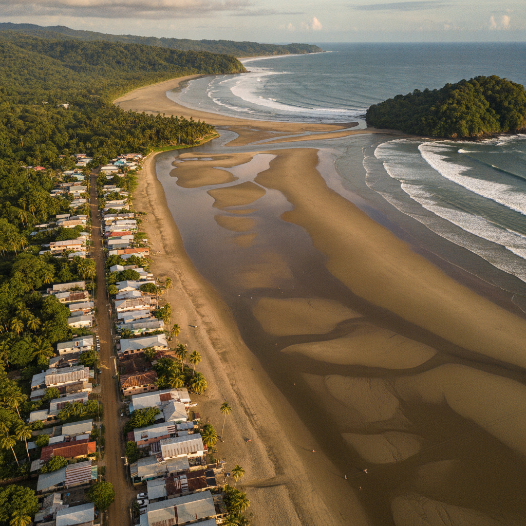
Jaco Beach, Dominical, and the Central Pacific Coast Circuit
The Central Pacific coast of Costa Rica between Jaco and Dominical forms a 60-kilometer arc of surf beaches, river estuaries, and forested headlands that together constitute the most accessible beach region from San Jose. Jaco, two hours from the capital, is the most developed beach town with the strongest surf; Dominical, thirty minutes south of Quepos, is a smaller surf village with a younger backpacker demographic. Manuel Antonio sits at the geographic center of this circuit. This route covers the coast as a regional system for travelers using Manuel Antonio as a base.
- 1
Jaco Beach: The Closest Pacific Beach to San Jose
Jaco, 110 kilometers west of San Jose, is the most accessible Pacific beach from the capital and consequently the most developed and crowded. The beach is a gray-sand surf beach with consistent waves attractive to beginner and intermediate surfers, and the town behind it has a full tourist infrastructure: surf schools, ATV rentals, zip lines, casinos, bars, and the full range of accommodation from hostels to all-inclusive resorts. Jaco has a reputation for being the most commercialized and least ecologically distinguished beach in Costa Rica, but its accessibility from San Jose and the volume of surf-compatible waves make it genuinely useful for short weekend trips from the capital.
- 2
Playa Hermosa de Jaco: Competitive Surf and Professional Waves
Eight kilometers south of Jaco, Playa Hermosa de Jaco (not to be confused with Playa Hermosa in Guanacaste) is a powerful beach break that consistently produces some of the best surf on the Central Pacific coast. The wave is a heavy shore break that punishes inexperienced surfers and rewards those who can read beach break conditions. Playa Hermosa has hosted the Costa Rica Surf Circuit and international professional surf competitions. The beach is accessed by a gravel road from the highway and has minimal development, maintaining a different atmosphere from the Jaco strip. The contrast between the two beaches, commercial and beginner-friendly versus wild and performance-level, within eight kilometers demonstrates the granularity of the Pacific coast surf geography.
- 3
Playa Esterillos and the Quiet Mid-Coast Beaches
Between Jaco and Quepos, several largely undeveloped beaches are accessible from the Costanera highway. Playa Esterillos Este, Oeste, and Centro form a long exposed beach system with minimal tourist infrastructure, a handful of small hotels, and consistent surf with far fewer people than Jaco. The road infrastructure has improved enough to make these beaches accessible as day trips from either Jaco or Quepos. The Punta Leona resort complex north of Esterillos is the major development in this stretch, an all-inclusive gated resort with private beach access that essentially removes a section of coastline from public use, a pattern that recurs along the Costa Rican Pacific coast.
- 4
Dominical: Surf Village, Waterfalls, and the Osa Gateway
Dominical, thirty kilometers south of Quepos on the Costanera highway, is a small surf village that has attracted a backpacker and yoga retreat demographic. The beach is a powerful beach break with unpredictable rip currents that has caused multiple drowning deaths; the water is for experienced surfers. The Nauyaca Waterfalls, seven kilometers inland from Dominical, are among the most spectacular in Costa Rica: two tiered falls dropping into a swimming pool accessible by a 14-kilometer round-trip hike or on horseback. Dominical serves as the gateway to the Osa Peninsula and Corcovado National Park, the most biodiverse place in Costa Rica, four hours further south on progressively worse roads.
- 5
Cerro de la Muerte: The Highway Through the Clouds
The Inter-American Highway between San Jose and the Pacific coast crosses the Cerro de la Muerte at 3,491 meters altitude, passing through paramo ecosystem, cloud forest, and dramatic highland scenery before descending to the Pacific lowlands. The drive is one of the most ecologically varied road experiences in Central America, moving from the Central Valley agricultural landscape through cloud forest to rainforest in under two hours. The pass is frequently in cloud and cold, and accidents on the winding road are a real risk. The highland zone supports the resplendent quetzal population of the San Gerardo de Dota valley, visible from the road in the morning during breeding season.
- 6
Weekend Circuit: San Jose to Jaco to Manuel Antonio Timing
The most common tourist circuit from San Jose runs west to Jaco for the first weekend stop and then continues south to Manuel Antonio or Quepos, returning via the Inter-American Highway through the mountains. The circuit can be done in three days at a compressed pace or five to seven days at a comfortable pace that allows the national park visit, a river rafting day, and adequate beach time. Shuttle bus services connect the destinations in two to three hour legs. The rental car option allows flexibility for stopping at lesser-known beaches and the Savegre Valley quetzal area but requires comfort with winding mountain roads and the occasional unpaved access track. All-inclusive packages combining flights, hotels, and transfers are heavily marketed and represent the least flexible but logistically simplest way to do the circuit.
Walk this route with audio
Stories play automatically as you reach each stop — no tapping needed.
More in Manuel Antonio
LGBTQ+ Travel in Manuel Antonio and the Costa Rica Context

Osa Peninsula and Corcovado: The Most Biodiverse Place on Earth
Manuel Antonio Practical Guide: Park Access, Accommodation Budget, and Seasonal Planning
Manuel Antonio: National Park, Wildlife, and the Pacific Coast Beach Experience
Manuel Antonio Food, Nightlife, and the Hillside Hotel Scene
