Galapagos Geology: Hotspot Volcanism and the Making of the Islands
The Galapagos Islands were formed by a volcanic hotspot, a fixed point of intense heat in the mantle over which the Nazca tectonic plate moves eastward at approximately 7 centimeters per year. The oldest islands in the southeast have been moving away from the hotspot for millions of years and are eroded and low; the youngest islands in the northwest, Fernandina and Isabela, remain directly over the hotspot and are still volcanically active. This conveyor belt of island formation means the archipelago is a geological time machine, with older eastern islands showing the progressive stages of erosion, subsidence, and eventual disappearance beneath the sea. The same geological forces that created the islands also created the unique isolation that drove the distinctive evolution of the Galapagos species.
- 1
The Galapagos Hotspot: How Volcanic Islands Form Over Fixed Heat Sources
A hotspot is a place in Earth mantle where heat rises more intensely than surrounding areas, partially melting the overlying oceanic crust and feeding volcanoes above. Unlike the volcanoes that form at tectonic plate boundaries, hotspot volcanoes form in the middle of plates and remain active as long as the hotspot burns beneath them. As the plate moves, the volcano above the hotspot is carried away, and a new volcano begins forming over the hotspot. The Hawaiian Island chain is the most famous hotspot chain, with the same conveyor-belt logic producing islands from Kauai in the northwest to the active Big Island in the southeast. The Galapagos chain follows the same principle but with the plate moving east and the islands arranged in a rough age gradient from young active Fernandina and Isabela in the west to older, eroded islands like Espanola in the southeast.
- 2
Shield Volcanoes: The Architecture of the Galapagos Islands
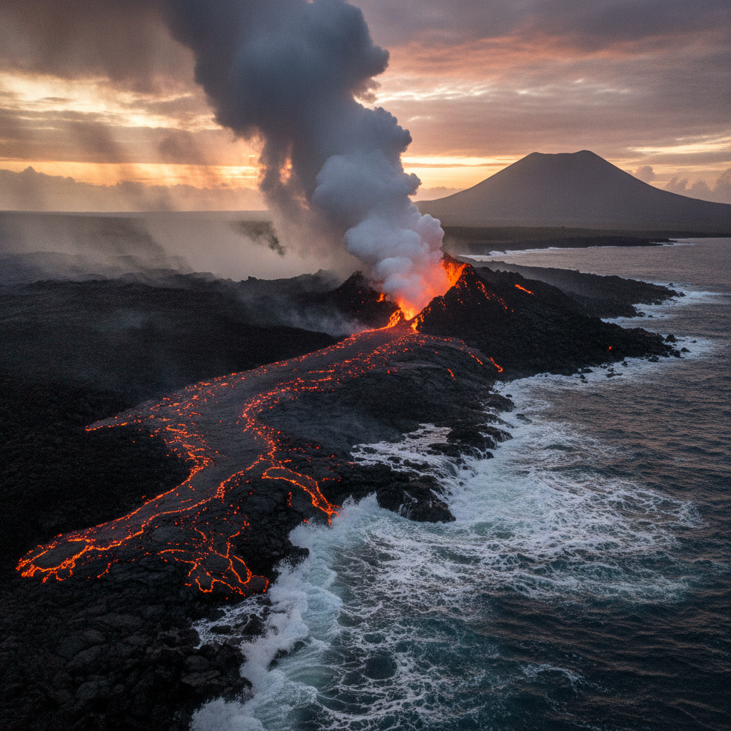
The volcanoes of the Galapagos are shield volcanoes, broad low-profile structures built by repeated flows of low-viscosity basaltic lava that spread widely before solidifying. Unlike the steep-sided stratovolcanoes of the Andes formed from more viscous andesitic magma, shield volcanoes produce lava that flows easily and creates the characteristic gentle slopes of the Galapagos islands. Isabela contains five distinct shield volcanoes, each with a visible caldera summit depression. Fernandina volcano, one of the most active on earth, has a caldera approximately 4 kilometers in diameter and 900 meters deep; the 2020 eruption added new lava flows to the already young western coast. The black lava flows of different ages are visible on every Galapagos island, ranging from sharp fresh pahoehoe lava that catches clothing to ancient eroded flows colonized by lichen and then by the pioneer plants that begin the slow process of soil formation.
- 3
Ocean Currents and the Galapagos Climate: Why the Islands Are Cooler Than Expected
The Galapagos sits on the equator, which would normally produce year-round tropical heat. Instead, the archipelago has a distinctly cooler climate than other equatorial island groups, determined by the ocean currents that wash its shores. The Humboldt Current, a cold upwelling from the depths of the southeastern Pacific, flows north along the South American coast and reaches the Galapagos from the south and southeast, bringing cold nutrient-rich water that supports the food chain underlying the extraordinary marine life. The Cromwell Current, flowing east along the equator from the deep Pacific, upwells against the western islands and creates the cold conditions that allow Galapagos penguins to live within one degree of the equator. Sea surface temperatures around the islands range from 15 degrees Celsius in the cold season August through October to 26 degrees Celsius in the warm season January through April.
- 4
Lava Types and Surfaces: Walking on Young Volcanic Rock
Two main types of basaltic lava surface are encountered on the Galapagos visitor trails. Pahoehoe lava, formed from faster-flowing lava that cools with a smooth, ropy, or wrinkled surface, is the more common type and forms the black shiny surfaces visible at many coastal visitor sites. Aa lava, formed from slower-moving more viscous flows, solidifies into sharp, jagged rubble that is extremely difficult to walk on and tears clothing and footwear. The distinction matters practically because visitor trails are routed to avoid the worst aa surfaces where possible. The color of lava flows indicates relative age: fresh flows are black, flows of intermediate age are colonized by white and orange lichens, and older flows are progressively greened by mosses, ferns, and eventually woody plants as thin soils develop. This color gradient makes the relative ages of different lava flows readable from the deck of a boat passing an island shoreline.
- 5
Tuff Cones and Crater Lakes: Secondary Volcanic Features
Some of the most distinctive landscapes on the Galapagos are created not by the main shield volcanoes but by phreatomagmatic eruptions, which occur when hot magma contacts seawater or groundwater and the explosive vaporization of the water fragments the magma into fine particles called tuff. These phreatomagmatic explosions build steep-sided conical craters called tuff cones at the interface of land and sea. The most photogenic example is the Pinnacle Rock on Bartolome Island, a jagged black tuff cone rising from the sea that appears on the cover of virtually every Galapagos publication. Crater lakes formed in old caldera depressions are found on several islands including Santa Cruz, where the twin crater lakes of Los Gemelos are surrounded by scalesia forest and are a reliable birdwatching site for vermilion flycatchers and woodpecker finches.
- 6
The Nazca Plate and Galapagos: Connections to the Wider Pacific Geology
The Galapagos sits on the Nazca Plate, one of the smaller oceanic tectonic plates that make up the Pacific Basin. The Nazca Plate is subducting beneath the South American continent along the Peru-Chile Trench on its eastern edge, a process that feeds the Andean volcanic chain and has built the Andes mountains over tens of millions of years. The same subduction of the Nazca Plate is responsible for the major earthquakes that periodically devastate Peru, Chile, and Ecuador. The spreading ridge at the western edge of the Nazca Plate, the East Pacific Rise, is one of the fastest-spreading mid-ocean ridges on earth and creates the new seafloor on which the Galapagos hotspot volcanoes are built. Understanding the Galapagos in this plate tectonic context connects the islands to the broader Pacific geological system and explains why the islands exist at their particular location in the vast equatorial Pacific.
Walk this route with audio
Stories play automatically as you reach each stop — no tapping needed.
More in Galapagos
Galapagos Giant Tortoises: Natural History, Near Extinction, and Recovery
Galapagos Diving and Snorkeling: Shark Aggregations and Underwater Wildlife
Galapagos Reptiles: Marine Iguanas, Land Iguanas, and Lava Lizards
Galapagos Conservation: The Human Presence, Tourism Management, and Future Threats
Galapagos Islands: Evolution Laboratory and the Most Fearless Wildlife on Earth