Atacama Geology: Salt Flats, Volcanoes, and the Science of the World's Driest Desert
The Atacama Desert is a geological laboratory of extraordinary richness, preserving in its extreme aridity geological features and biological records that would be destroyed by moisture in any wetter environment, from the ancient salt flat deposits that record millions of years of Andean uplift to the active volcanic system of the altiplano that continues to reshape the desert surface.
- 1
Why the Atacama is the Driest Desert on Earth
The extreme aridity of the Atacama results from the convergence of three independent drying mechanisms: the cold Humboldt Current that cools the air masses arriving from the Pacific and prevents moisture from forming clouds that would penetrate inland; the rain shadow of the Andes that blocks moisture from the Amazon basin on the east; and the subtropical high pressure zone that suppresses precipitation throughout the region. The combination of these three factors creates a desert where some weather stations have never recorded measurable rainfall in recorded history.
- 2
Salar de Atacama: The Chemistry of a Giant Salt Flat
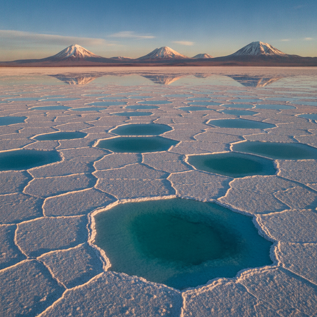
The Salar de Atacama, 3,000 square kilometers of salt crystal at 2,305 meters elevation, is the remnant of an ancient lake that occupied the Atacama basin before the Andean uplift blocked the drainage to the Pacific; the salt flat contains the world's largest lithium brine deposit, and the lithium extraction operations visible at the southern end of the salar are the primary source of the battery-grade lithium carbonate that has become essential to the electric vehicle industry.
- 3
The Altiplano Volcanoes: Licancabur and the Bolivian Border
The border between Chile and Bolivia along the Atacama altiplano is marked by a series of volcanic cones including the Licancabur at 5,916 meters, whose perfectly symmetrical profile is the visual icon of the San Pedro de Atacama landscape. The Licancabur summit contains a crater lake at the highest altitude in the world, preserved by the extreme aridity that prevents the lake from evaporating despite the intense solar radiation at that altitude.
- 4
El Tatio Geology: Geothermal Systems and the Andean Hydrothermal Circuit
The El Tatio geyser field is fed by a geothermal system in which surface water, partially of ancient origin, percolates downward through permeable volcanic rock to depths where geothermal heating brings it close to boiling point before it rises through the geyser conduits to the surface. The chemistry of the El Tatio water, enriched in silica and other minerals from the volcanic rock, creates the colorful terraces and pools around the active vents.
- 5
Lava Fields and Ignimbrites: The Volcanic Surface of the Atacama
The Atacama plateau is covered in large areas by ignimbrite deposits, the sheets of welded volcanic ash produced by the large explosive eruptions that have characterized the Andean volcanic system throughout the Quaternary period. The ignimbrite landscapes of the altiplano between San Pedro de Atacama and the Bolivian border create a moonscape of pale volcanic rock punctuated by the darker cones of more recent lava eruptions.
- 6
Fossil Shores and Paleontological Heritage
The Atacama coastal zone contains remarkable paleontological deposits including the Paleontological Park of Bahia Inglesa south of Copiapo, where the fossilized remains of marine animals from the Miocene epoch, when a warm shallow sea covered the current desert coastline, are preserved in the desert sediments. Whale, dolphin, shark, and sea turtle fossils from 7 to 10 million years ago provide evidence of the completely different marine environment that preceded the development of the modern Humboldt Current cold-water system.
Walk this route with audio
Stories play automatically as you reach each stop — no tapping needed.
More in Atacama
Atacama Wildlife: Vicunas, Flamingos, Viscachas, and the Andean Cat
Atacama Desert: Moon Valley, El Tatio Geysers, Flamingo Lagoons, and the World's Best Stargazing
Atacama Nitrate Era: Ghost Towns, Humberstone, and the Rise and Fall of White Gold
Atacama Astronomy: ALMA, World-Class Observatories, and Astrophotography
Atacameno Culture: Pukara Fortresses, Village Traditions, and 10,000 Years of Desert Life